Winter Maintenance Best Practices
Winter Maintenance Best Practices WestCOG offers a free winter maintenance training video to train public works staffers on considerations and best practices when it comes …
Winter Maintenance Best Practices WestCOG offers a free winter maintenance training video to train public works staffers on considerations and best practices when it comes …
The Metropolitan Area Planning (MAP) Forum announces the next meeting of its Multi-State Freight Working Group on September 14, 2021 at 10:00 am. This meeting …
Regional Waste Authority Study Purpose To study and implement regional waste collaboration efforts between WestCOG municipalities that do not currently belong to a regional waste …
LAND USE PLANNING FOR WIRELESS TELECOMMUNICATIONS TASK FORCE The strength of the nation’s economy is directly linked to the speed of broadband services as local …
The Section 5310 program provides Federal funding for capital expenses (up to 80% of total project cost) and operating expenses (up to 50% of total …
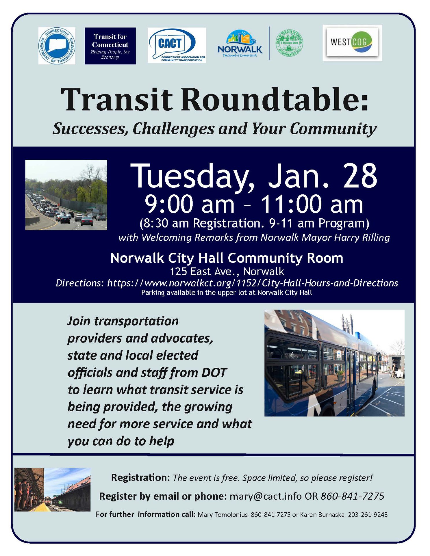
Join us at the Transit Roundtable: Successes, Challenges and Your Community at the Norwalk City Hall Community Room on Tuesday, January 28th, 9-11AM. Please register, …
The 2019 Annual Meeting of the Metropolitan Area Planning (MAP) Forum The Metropolitan Area Planning (MAP) Forum announces its 2019 Annual Meeting on December 13, …
Danbury and New Fairfield Route 37 Corridor Study Study Overview Deliverables Public Meeting Technical Advisory Committee Study Overview WestCOG, in collaboration with the City of …